
Agras T70P for Solar Farm Survey Work in Complex Terrain
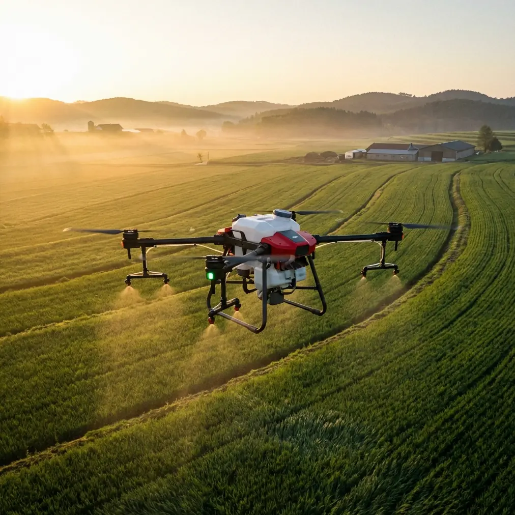
Agras T70P for Solar Farm Survey Work in Complex Terrain: What Actually Changes in the Field
META: A field-driven look at how Agras T70P fits solar farm survey operations in difficult terrain, with practical insight on airspace compliance, flight control, precision, and operator workflow.
I remember one hillside solar site where the panels were the easy part. The hard part was everything around them: uneven access roads, sharp elevation changes, narrow service corridors, gusts rolling over the ridgelines, and a flight planning process that kept changing because local operating rules were moving faster than most field teams could keep up with.
That is the right context for discussing the Agras T70P.
Not as a brochure object. Not as a generic “ag drone” dropped into a non-ag application. But as a working aircraft that has to earn its place on a solar survey job where terrain complexity, flight consistency, and regulatory clarity matter more than marketing claims.
For teams surveying solar farms, especially in places where local unmanned flight rules are being updated, the aircraft is only part of the equation. The rest is control precision, repeatability, and whether the operator can keep the machine stable and productive when the site is awkward.
The real bottleneck is not always the drone
People often assume complex-terrain survey work is limited by payload or raw endurance. Sometimes it is. More often, the problem starts earlier.
It starts with whether the aircraft can be flown with enough finesse to maintain clean lines over irregular topography. It starts with whether the pilot can make small corrections without overcontrolling. And it starts with whether the mission can even be launched legally and predictably under current airspace rules.
That last point deserves more attention than it usually gets.
A recent change in Zhejiang made that obvious. The province’s revised unmanned aircraft suitable-flight airspace map officially went live at 00:00 on May 14, and it was implemented under the Interim Regulations on the Flight Management of Unmanned Aircraft along with related requirements from the central air traffic management authority. That sounds administrative, but in operations it has teeth. When a province redraws and republishes suitable flight areas, route planning, launch procedures, and location viability can all shift overnight.
For a solar survey contractor running multiple sites, that means the smartest aircraft in the world still loses value if the operational framework around it is not understood. On the other hand, if your team treats airspace updates as part of mission design, the T70P becomes more useful because it can be deployed with fewer surprises.
Why this matters specifically for Agras T70P users
The Agras line is usually discussed in agricultural terms, but the underlying operational lesson translates well to solar infrastructure work: repeatable low-altitude flight over large, structured ground environments.
Solar farms are not flat football fields. Even when the panel layout looks orderly on a project map, the actual site can introduce sudden rises, erosion channels, drainage cuts, and edge obstacles that punish sloppy control. That is where control discipline matters.
One detail from DJI’s training ecosystem is surprisingly relevant here. In the TT educational drone material, the flight model is broken down into the basics of throttle, yaw, pitch, and roll, with a simple but operationally crucial point: joystick deflection directly affects movement speed. Push farther and the aircraft moves faster, whether that is lateral motion, forward travel, or rotation rate.
That may sound elementary. It is not.
On a solar site, especially one built across stepped or sloped land, excessive stick input creates three problems immediately:
- It increases path inconsistency.
- It makes image overlap or observation rhythm less predictable.
- It amplifies pilot workload in wind or near structural rows.
If you are using the Agras T70P around panel blocks, transformer pads, service lanes, or drainage edges, smooth input matters more than aggressive maneuvering. The lesson from the training document is that control quality is scalable from education-grade aircraft all the way up to serious commercial platforms: speed is a choice, and on complicated terrain, restraint preserves data quality and safety margins.
The hidden value of better control ergonomics
The same TT material also mentions that a GameSir T1D controller can be paired to the tablet over Bluetooth, while the aircraft remains connected to the tablet over Wi-Fi. Again, that reference is not about the T70P itself. But the operational principle is useful: when you improve the human-machine interface, you improve the quality of the mission.
This is one of the most overlooked factors in complex-terrain survey work.
Touchscreen control is fine for training, familiarization, or simple environments. But precision inspection and survey tasks over solar assets often benefit from tactile input, especially when the operator needs to modulate lateral drift, maintain a consistent swath width, or make fine yaw adjustments while tracking rows on uneven ground. A physical controller reduces hunting, reduces awkward corrections, and helps the pilot hold a cleaner line.
That becomes even more relevant when teams are trying to maintain strong RTK fix rate and centimeter precision in workflows that may later be compared against previous site records. Precision is not only about satellite corrections or onboard positioning. It is also about whether the pilot’s hands are introducing unnecessary variability.
In other words, if the T70P is being used in a sophisticated commercial environment, the aircraft should be treated as part of a wider control system, not as a self-sufficient flying appliance.
Solar survey work borrows more from multirotor history than many realize
The T70P exists because the multirotor sector matured beyond hobby experimentation. That evolution matters.
The historical references in the technical lecture are a useful reminder. Microdrones introduced the Md4-200 in 2006 and the Md4-1000 in 2010. Draganflyer launched the Draganflyer IV in 2004 and later the industrial X6 in 2008. Around the same period, the Mikrokopter open-source project helped shape practical multirotor development, while academic groups built test environments to validate control algorithms, especially attitude control.
Why bring that up in an article about surveying solar farms with an Agras T70P?
Because today’s field expectations were built on that era’s hard lessons. Stable attitude control, predictable response, low-altitude repeatability, and confidence in multirotor autonomy did not appear by accident. They came from years of industrial product development and research testbeds such as MIT’s real-time indoor autonomous vehicle environment and UPenn’s multiple micro-UAV platform.
For the operator standing on a steep solar access track, this history has a practical meaning: modern multirotors are good at structured, repeatable low-altitude work because the entire segment has spent nearly two decades refining stability and control.
The T70P benefits from that lineage. That matters when you are flying beside long rows of reflective infrastructure where poor attitude behavior can quickly turn a survey into a reflight.
Where Agras T70P can ease a past pain point
On difficult solar sites, one recurring frustration is managing the tradeoff between coverage speed and detail retention.
Fly too aggressively and you risk introducing uneven passes, poor observation angles, or inconsistent spacing. Fly too conservatively and the job drags, especially across large installations with fragmented blocks separated by roads or terrain breaks.
What changes with a platform like the T70P is not magic. It is workflow confidence.
A stable heavy-duty multirotor gives crews more breathing room when operating in variable terrain. That can make it easier to hold a disciplined line, preserve intended swath width, and stay usable even when conditions are less forgiving than they looked on a desktop map. On sites where dust, moisture, and washdown realities are part of the job, ruggedness also matters. That is why field teams pay attention to details such as IPX6K-class protection. Not because it sounds impressive, but because solar projects are outdoor assets, and survey schedules do not always align with clean, dry, laboratory conditions.
The same logic applies to terms like multispectral, spray drift, and nozzle calibration, even if they originate more naturally in agricultural discussions. For solar work, they are useful as reminders that aircraft configuration should match the task. If a platform can be adapted across data collection or site management scenarios, the operator still has to calibrate the mission to the objective. Wrong settings waste time. Wrong assumptions waste whole site days.
That is the piece many buyers miss. The aircraft does not remove the need for method. It rewards good method.
Airspace updates are now part of mission planning, not a footnote
Let’s come back to Zhejiang.
A provincial remapping of suitable unmanned flight airspace is not just a headline for compliance managers. It affects where and how survey providers mobilize. If your solar projects span multiple counties or development zones, a newly published airspace boundary can alter launch-point choices, route segmentation, and the paperwork rhythm around a site visit.
For T70P operators, the operational significance is direct:
- Site feasibility checks need to happen before crew dispatch, not on arrival.
- Existing route libraries may need revision after a regulatory redraw.
- Training should include location validation, not only aircraft handling.
- “We flew here before” is no longer evidence that today’s mission profile still fits.
That is a mature-operations mindset. And mature operations are where aircraft like the T70P deliver the most value.
The pilot still makes the mission
One of the strongest lessons buried in the TT training material is that the aircraft holds altitude when the throttle is centered and stops rotating when yaw input returns to neutral. Those are basic control truths, but they point to something larger: good flying is often about returning the system to stability quickly and intentionally.
That is exactly how competent T70P work looks on a solar survey site.
The pilot does not chase every wobble. The pilot does not overcorrect after a gust. The pilot does not rush transitions between panel zones. The pilot inputs what the aircraft needs, then gets out of the way.
That style of flying is especially valuable when working near repeating infrastructure where visual references can trick less experienced operators into drifting or overbanking. In complex terrain, discipline beats bravado every time.
If your team is refining that workflow and wants a second opinion on controller setup, site-fit questions, or survey planning around local airspace changes, you can message a field specialist here: https://wa.me/85255379740.
What to evaluate before choosing Agras T70P for solar survey tasks
The best reason to consider the T70P is not that it is powerful. Plenty of platforms are powerful. The better reason is whether it reduces friction in your actual operating environment.
Ask these questions:
1. Can your team maintain precise flight paths over uneven terrain?
If not, the problem may be training, control interface, or mission planning, not the aircraft alone.
2. Are you accounting for local airspace changes before deployment?
The Zhejiang update that took effect on May 14 is a useful reminder that regulation can reshape operational reality quickly.
3. Does your workflow depend on repeatability?
If you are comparing recurring site conditions, inspecting changes over time, or integrating georeferenced observations, centimeter precision and a reliable RTK fix rate become meaningful.
4. Is the platform rugged enough for real outdoor infrastructure work?
Surveying solar farms means dust, heat, moisture, and rough staging areas. Protection ratings such as IPX6K are not decorative details.
5. Have you matched operator controls to task difficulty?
The TT controller reference may come from an education product, but the lesson holds: tactile control can materially improve maneuver quality.
The bottom line
Agras T70P makes the most sense for solar farm survey teams when it is treated as part of a disciplined field system. That system includes airspace awareness, refined pilot input, precision workflow design, and hardware choices that suit outdoor infrastructure work.
The industry got here through a long multirotor development arc, from early platforms like Draganflyer IV in 2004, Md4-200 in 2006, and industrial systems that proved multirotors could do serious work. Today, the expectation is higher. A commercial aircraft is supposed to be stable, repeatable, and operationally sensible.
On a complicated solar site, that is exactly the standard that matters.
Ready for your own Agras T70P? Contact our team for expert consultation.