
Agras T70P for Remote Site Scouting: A Field Method That
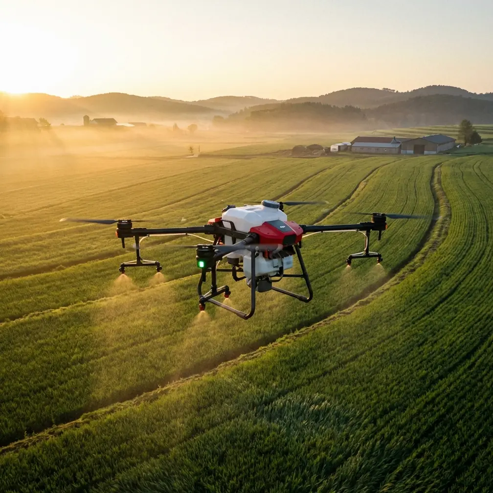
Agras T70P for Remote Site Scouting: A Field Method That Prevents Bad Data and Wasted Flights
META: A practical how-to for using the Agras T70P on remote construction scouting missions, with flight planning, route discipline, control-link thinking, and payload strategy grounded in real UAV operating principles.
Remote construction scouting sounds simple until the first bad pass ruins the whole sortie.
You send the aircraft out to inspect haul roads, drainage cuts, stockpiles, and access corridors. The live view looks acceptable at first. Then the feed stutters. The aircraft drifts off the line you intended. By the time the team notices the coverage gap, the flight path is already compromised and the return trip turns into a correction exercise instead of a productive survey.
That is exactly why the Agras T70P deserves a more disciplined operating method than the usual “launch and look around” routine.
Even though the T70P sits in the agricultural category, its value for remote site scouting comes from something broader: it can be treated as a structured work platform rather than a casual camera drone. For construction teams operating far from paved access, that distinction matters. The aircraft is not just there to show you what is on site. It is there to produce repeatable, navigable, decision-ready observations.
This guide lays out a practical operating approach for the Agras T70P in remote scouting work, using a few core principles from UAV training and control-system logic that are often ignored. Those principles are simple: keep the aircraft inside a manageable command envelope, make the ground station do real work, and fix route errors early instead of trying to rescue them later.
Start with the right mindset: scouting is a route problem before it is a sensor problem
Most teams overfocus on payloads. They talk about camera quality, multispectral options, or whether centimeter precision is available through RTK. Those are valid questions. But on a remote construction site, the first failure point is usually not the payload. It is the route.
A training reference for model aircraft makes a point that translates surprisingly well to professional drone operations: the operator should constantly judge where the aircraft is actually flying, not where they hope it is flying. That sounds basic, but it has operational teeth. If you let the aircraft continue on a flawed line and try to salvage the mission later, you can spend a minute or two repositioning and realigning instead of collecting useful data. On a worksite, that means battery loss, daylight loss, and a weaker record for later comparison.
With the Agras T70P, this becomes even more relevant because the aircraft is capable enough to cover ground quickly. Speed is an advantage only if the line is right. If the line is wrong, speed just gets you to bad data faster.
The practical takeaway is this: for remote scouting, define each pass around a visible reference line on the site plan before takeoff. That might be a temporary road, a trench edge, a fence line, a spoil berm, or a drainage path. Then fly every leg with one question in mind: is the aircraft still tracking the line I assigned, relative to my control reference?
That sounds old-school, but it prevents the most common remote-site mistake: collecting footage that looks useful in the moment yet cannot be compared cleanly against the previous visit.
Treat the ground station as the center of the mission
One of the most useful facts in the reference material is not glamorous at all: the ground control system is the operational core of the UAV system. It handles flight monitoring, mission planning, route planning, flight data display, image display, and sends program instructions to the aircraft. In some situations, it also allows direct manual intervention.
That is exactly how the Agras T70P should be used on a construction scouting job.
Too many operators treat the controller screen as a viewing device. It is not. It is the command layer. The T70P performs best when the ground side is set up to actively process what is being received and to modify the flight path when site reality changes. On a remote jobsite, site conditions rarely match the tidy assumptions made back at the office. A haul route may be blocked. Dust may hide surface detail. A newly excavated depression may require a lower pass and a narrower observation angle. The ability to revise the route during the mission is not a luxury. It is part of getting a usable result.
The reference material also mentions a ground-end setup made up of a computer, controller, and display device. That architecture matters for T70P fieldwork because remote scouting is often a team activity, not a one-person hobby flight. One person may handle aircraft control, another may watch terrain changes, and another may compare the feed with the site plan or previous scouting records. If you are trying to document slope instability, drainage migration, or material movement, that shared ground view gives the mission much more value than a pilot flying from instinct alone.
This is one area where the T70P can outperform lighter, consumer-style alternatives in real operations. Competitor platforms often look attractive on paper, but when the task shifts from simple viewing to structured site management, the winner is usually the aircraft that fits into a stronger command-and-monitor workflow.
Control-link discipline matters more on remote sites than people expect
Another reference detail is easy to overlook but extremely practical: a training drone using Wi-Fi video transmission is recommended to stay within about 50 meters of the ground side because pushing too far can degrade the feed or even break the connection with the controller or computer.
The Agras T70P is not that educational aircraft, and no serious operator should confuse the systems. But the operating lesson still holds.
Live video and command confidence are not abstract concepts. On remote construction sites, terrain, machinery, steel structures, temporary buildings, and dust can all interfere with situational awareness. A drone can be technically airborne and still be operationally “far away” if the operator’s ability to interpret and command it starts degrading.
That is why good T70P scouting practice borrows the discipline behind that 50-meter recommendation even if the aircraft itself operates on a very different class of system. The principle is to avoid flying beyond the zone where the crew can confidently verify route accuracy, image quality, and terrain context in real time.
In other words, don’t ask only, “Can the aircraft reach that far?” Ask, “Can the mission still be supervised well from here?”
That distinction separates professional site scouting from casual flying.
For a long remote corridor, the answer is often to reposition the ground team instead of stretching one launch position too far. Leapfrogging the takeoff point may feel slower. In practice, it usually protects data quality, reduces route deviation, and cuts down on the ugly middle portion of a mission where everyone is guessing whether the aircraft is still delivering what the plan required.
Build each scouting run around repeatable passes
The model-flight training source contains another insight worth stealing: if the aircraft comes out of a turn in the wrong place, the first thing to adjust is often the start point of the turn, not the turn itself.
That is excellent advice for the Agras T70P on construction scouting.
Operators often react to a poor alignment by overcontrolling the aircraft midway through the pass. That creates inconsistent footage, variable stand-off distance, and uneven overlap if the mission is also supporting mapping or progress documentation. The better fix is upstream. Change where the leg begins. Change the setup distance. Change the angle of entry.
If you are checking a long retaining edge, a utility trench, or a developing erosion line, a clean setup creates a clean pass. A messy setup produces a pass full of small corrections, and those corrections make later interpretation harder.
Here is a workable sequence:
1. Mark the observation lanes before launch
Decide which lines matter. For remote site scouting, that may include:
- access roads
- cut-and-fill transitions
- drainage paths
- slope toes and crests
- stockpile edges
- staging zones
- perimeter fencing or encroachment boundaries
Do not lump them into one wandering flight. Break them into lanes.
2. Define your reference point from the operator’s position
The training material stresses using yourself as a reference and repeatedly judging where the aircraft is headed relative to that position. On a worksite, that translates into a simple but effective rule: every pass should have a known relationship to the pilot station or mobile control point.
That helps the crew detect early drift. It also makes repeated site visits more comparable because the aircraft’s geometry relative to the subject stays more consistent.
3. Fly a stable line before trying for detail
If the route is not stable, the close inspection will not help. Get the leg right first. Then tighten the observation height or camera angle on the next pass if needed.
4. Correct entry timing, not just mid-pass steering
When a pass starts wrong, rebuild the approach. Don’t patch it with constant stick inputs.
5. End each pass where the next one can begin cleanly
This is where productivity improves fast. Each completed line should set up the next one logically. That avoids the wasted repositioning that quietly consumes batteries on real jobs.
Payload thinking: don’t copy farm workflow blindly
Because the Agras T70P comes from an agricultural lineage, some teams assume its usefulness for scouting depends on adapting spray-style operating patterns directly to construction. That is not the right approach.
Terms like swath width, spray drift, and nozzle calibration belong to agricultural output control. For site scouting, they matter mainly as indicators of how precisely the aircraft can be managed as a working platform. A drone designed to maintain controlled coverage patterns and disciplined application behavior has underlying value for observation work too. It suggests the airframe and flight logic are built around consistency, not improvisation.
That consistency is where the T70P gains ground against looser competitors. A platform that can repeatedly hold planned spacing and route logic is far more useful for monitoring earthworks progress than one that merely offers a sharp image.
If your scouting workflow includes RTK-based documentation, the phrase that matters is not just “centimeter precision” but whether you can maintain a dependable RTK fix rate across the site. Precision that drops in and out around obstructions, terrain breaks, or temporary structures can turn a supposedly accurate record into a patchwork. On remote sites, always review where fix reliability may be challenged before mission start. The aircraft’s capabilities are only as useful as the consistency of the environment they are working in.
Weather, dust, and washdown change the maintenance conversation
Remote construction scouting is dirty work. Mud, aggregate dust, standing water, and vehicle spray are not occasional nuisances; they are normal conditions. That is why ruggedness markers such as IPX6K-level protection deserve attention in aircraft selection and operating planning. Not because they make the drone invincible, but because they reduce the gap between ideal brochure conditions and actual field abuse.
The T70P’s real advantage here is operational continuity. On a wet site or a dusty grading project, an aircraft that tolerates repeated exposure and practical cleanup is simply easier to keep in service. That means fewer mission cancellations due to environmental hesitation and more confidence in regular scouting intervals.
A simple field method for remote construction teams
If I were deploying the Agras T70P for recurring remote site checks, I would standardize the job this way:
- Use a fixed checklist for launch point, route lanes, and visual references.
- Keep the ground station active as a planning and intervention tool, not just a monitor.
- Break the mission into short, repeatable passes rather than one sprawling reconnaissance lap.
- Reposition the crew when link confidence or route verification drops.
- Review every pass for whether the setup was wrong, not just whether the steering looked rough.
- Keep records consistent enough that today’s flight can be compared against last week’s without guesswork.
That is how you turn a powerful aircraft into a dependable site instrument.
If you are building a scouting workflow around the Agras T70P and want a field-oriented conversation about route structure, payload fit, or control setup, you can start here: message Marcus directly.
The bottom line on the Agras T70P for remote scouting
The most useful lesson from the source material is not about glamour specs. It is about operational discipline.
A training drone’s 50-meter Wi-Fi guideline reminds us that control confidence has limits, and good operators respect the supervision envelope. The ground station description reminds us that planning, monitoring, path changes, and manual override belong at the center of the mission. The route-training guidance adds the missing piece: if the line is drifting, solve the setup early instead of wasting time correcting late.
Applied to the Agras T70P, those ideas create a very practical edge. The aircraft becomes more than a platform that can fly over a construction site. It becomes a repeatable scouting system for teams that need usable site intelligence from difficult ground conditions.
That is where it excels. Not in hype. In disciplined, repeatable fieldwork.
Ready for your own Agras T70P? Contact our team for expert consultation.