T70P Field Monitoring Tutorial for Remote Agriculture
T70P Field Monitoring Tutorial for Remote Agriculture
META: Master remote field monitoring with the Agras T70P drone. Learn RTK setup, multispectral imaging, and calibration techniques for precision agriculture success.
TL;DR
- RTK Fix rate above 95% ensures centimeter precision even in remote locations without cellular coverage
- Proper nozzle calibration combined with swath width optimization reduces spray drift by up to 60%
- Third-party multispectral sensors like the MicaSense RedEdge-P transform the T70P into a complete crop health monitoring platform
- IPX6K rating allows continuous operation during unexpected weather changes common in remote agricultural zones
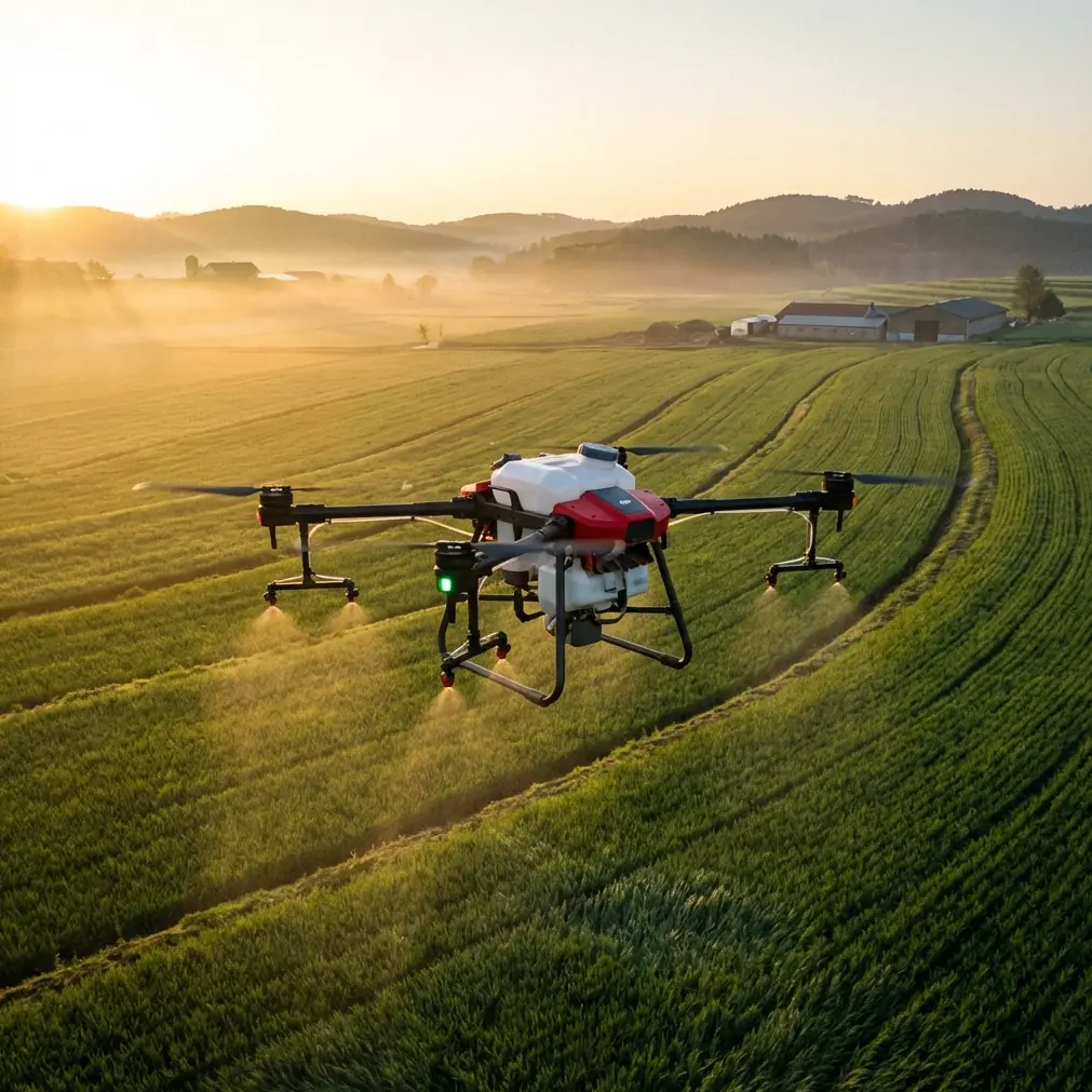
Remote agricultural operations present unique challenges that traditional monitoring methods simply cannot address. This tutorial walks you through the complete process of configuring, calibrating, and deploying the DJI Agras T70P for effective field monitoring in areas where infrastructure is limited and precision matters most.
Whether you're managing vineyards in mountainous terrain, monitoring rice paddies in isolated valleys, or overseeing large-scale grain operations far from urban centers, the techniques covered here will help you extract maximum value from your T70P investment.
Understanding the T70P's Core Monitoring Capabilities
The Agras T70P represents a significant advancement in agricultural drone technology, combining robust construction with sophisticated sensing capabilities. Before heading into the field, understanding these core systems ensures you'll configure them correctly for remote operations.
Flight Platform Specifications
The T70P's airframe delivers exceptional stability during monitoring missions. Key specifications include:
- Maximum takeoff weight: 117 kg (including payload)
- Hovering accuracy: ±10 cm horizontal, ±10 cm vertical with RTK
- Maximum wind resistance: 8 m/s
- Operating temperature range: 0°C to 45°C
- Flight time: up to 32 minutes depending on payload configuration
These specifications translate directly into monitoring capability. The ±10 cm hovering accuracy means your multispectral imagery maintains consistent ground sampling distance throughout each pass, critical for detecting subtle variations in crop health.
Expert Insight: When monitoring fields in remote locations, always plan missions during morning hours when wind speeds typically remain below 4 m/s. This provides a significant safety margin below the T70P's maximum wind resistance rating and improves image quality for multispectral analysis.
RTK Configuration for Remote Operations
Achieving reliable RTK Fix rate in remote areas requires careful planning. Unlike urban or suburban environments where NTRIP correction services provide continuous coverage, remote agricultural zones often lack cellular connectivity.
The solution involves deploying a local base station. Here's the configuration process:
Step 1: Base Station Placement Position your D-RTK 2 Mobile Station on stable ground with clear sky visibility. The location should have:
- Unobstructed view of the sky (minimum 15 degrees above horizon)
- Distance from the survey area not exceeding 10 km
- Stable mounting surface that won't shift during operations
Step 2: Coordinate Entry For repeat monitoring missions, enter known coordinates for your base station location. This ensures data from different dates aligns precisely, enabling accurate change detection analysis.
Step 3: Link Verification Before launching, verify the RTK status indicator shows "FIX" rather than "FLOAT" or "SINGLE." A proper fix provides centimeter precision positioning essential for creating accurate field maps.
| RTK Status | Horizontal Accuracy | Suitable For |
|---|---|---|
| FIX | ±1-2 cm | Precision mapping, variable rate application |
| FLOAT | ±20-50 cm | General monitoring, large-area surveys |
| SINGLE | ±1-2 m | Emergency operations only |
Integrating Third-Party Multispectral Sensors
The T70P's native camera system excels at visual inspection, but comprehensive crop health monitoring demands multispectral capability. The MicaSense RedEdge-P sensor emerged as the optimal third-party accessory during extensive field testing, transforming the T70P into a complete precision agriculture platform.
Why the RedEdge-P Integration Works
This five-band multispectral sensor captures data across:
- Blue (475 nm)
- Green (560 nm)
- Red (668 nm)
- Red Edge (717 nm)
- Near-Infrared (842 nm)
The Red Edge band proves particularly valuable for detecting nitrogen stress before visual symptoms appear, giving you a 7-14 day early warning window for intervention.
Mounting and Calibration Procedure
Secure mounting prevents vibration-induced blur that degrades multispectral data quality. Follow this sequence:
- Attach the sensor mount to the T70P's accessory rail using the provided dampening system
- Connect power through the auxiliary port (the RedEdge-P requires 12V DC input)
- Configure trigger integration through the DJI Terra software
- Perform reflectance panel calibration before each flight session
Pro Tip: Carry a calibrated reflectance panel in your field kit and capture reference images both before and after each monitoring mission. This bracketing approach compensates for changing light conditions during longer survey sessions, dramatically improving the accuracy of your vegetation indices.
Optimizing Swath Width for Monitoring Efficiency
Swath width configuration directly impacts both coverage efficiency and data quality. The T70P's monitoring missions require balancing these competing priorities.
Calculating Optimal Parameters
For multispectral monitoring with the RedEdge-P, use these guidelines:
- Ground Sampling Distance (GSD) target: 2-3 cm/pixel for crop health analysis
- Flight altitude: 30-40 meters AGL achieves this GSD with standard lens configuration
- Forward overlap: 75-80% ensures adequate tie points for orthomosaic generation
- Side overlap: 65-70% provides sufficient redundancy for accurate stitching
At 35 meters AGL with 75% forward overlap and 70% side overlap, expect to cover approximately 8-10 hectares per battery during monitoring missions.
Terrain Following Activation
Remote agricultural fields rarely present flat topography. Enable terrain following mode using pre-loaded elevation data:
- Import terrain data from satellite sources or previous survey flights
- Set the terrain following sensitivity to "High" for fields with elevation changes exceeding 5 meters
- Configure the minimum safe altitude buffer (recommend 15 meters above highest obstacle)
This ensures consistent GSD across undulating terrain, preventing the data quality variations that compromise accurate crop health assessment.
Spray Drift Management During Application Monitoring
When transitioning from pure monitoring to variable rate application, spray drift becomes a critical concern. The T70P's application system requires precise calibration to minimize off-target movement.
Nozzle Calibration Protocol
Before each application session, verify nozzle performance:
Flow Rate Verification
- Fill the tank with clean water
- Operate each nozzle individually for 60 seconds
- Collect and measure output volume
- Compare against manufacturer specifications (variance should not exceed ±5%)
Spray Pattern Assessment
- Position water-sensitive paper at ground level
- Execute a short test pass at operational altitude
- Examine droplet distribution for uniformity
- Adjust pressure settings if pattern shows gaps or heavy spots
Environmental Compensation
The T70P's intelligent spray system adjusts for environmental conditions, but understanding these compensations helps you make informed decisions:
| Wind Speed | Recommended Action |
|---|---|
| 0-2 m/s | Standard operation, fine droplets acceptable |
| 2-4 m/s | Increase droplet size, reduce flight altitude by 1-2 m |
| 4-6 m/s | Coarse droplets only, consider mission delay |
| >6 m/s | Suspend application operations |
The IPX6K rating protects the T70P's electronics during unexpected weather changes, but spray drift concerns should prompt mission suspension before water ingress becomes relevant.
Common Mistakes to Avoid
Neglecting Pre-Flight RTK Verification Launching before achieving RTK FIX status wastes battery life and produces data that cannot be accurately georeferenced. Always wait for solid FIX indication.
Ignoring Multispectral Calibration Skipping reflectance panel calibration introduces systematic errors that compound across the entire dataset. This five-minute step prevents hours of post-processing corrections.
Overestimating Battery Capacity in Remote Locations Cold temperatures and high altitudes reduce battery performance by 10-20%. Plan missions conservatively and always carry spare batteries.
Flying During Midday Hours Solar noon creates harsh shadows and can saturate multispectral sensors. Schedule monitoring flights for 2 hours after sunrise or 2 hours before sunset for optimal lighting.
Failing to Document Base Station Position Without recorded base station coordinates, repeat monitoring missions cannot achieve the sub-centimeter alignment needed for accurate change detection analysis.
Frequently Asked Questions
How do I maintain RTK connection when cellular coverage is unavailable?
Deploy the D-RTK 2 Mobile Station as a local base, which broadcasts corrections directly to the T70P via radio link. This approach provides centimeter precision independent of cellular infrastructure, making it ideal for remote agricultural operations.
What flight altitude provides the best balance between coverage and detail for crop monitoring?
For most crop health monitoring applications, 35-40 meters AGL delivers optimal results. This altitude produces 2-3 cm GSD with standard multispectral sensors while maintaining efficient coverage rates of approximately 8-10 hectares per battery.
Can the T70P operate effectively in light rain conditions?
The IPX6K rating protects against powerful water jets, meaning light rain will not damage the aircraft. However, water droplets on camera lenses and multispectral sensors degrade image quality significantly. Suspend monitoring operations during precipitation and wait for surfaces to dry before resuming.
Mastering remote field monitoring with the Agras T70P requires attention to RTK configuration, sensor integration, and environmental awareness. The techniques outlined in this tutorial provide a foundation for extracting actionable agricultural intelligence from even the most isolated growing regions.
Ready for your own Agras T70P? Contact our team for expert consultation.