Agras T70P in High-Altitude Vineyards: What Actually
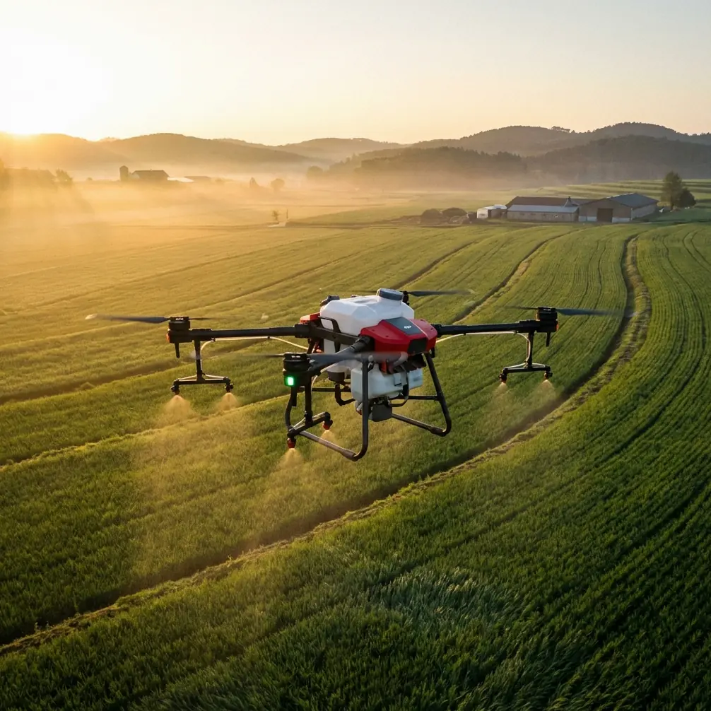
Agras T70P in High-Altitude Vineyards: What Actually Matters When Mapping and Planning Spray Work
META: Practical Agras T70P field guidance for high-altitude vineyard mapping, spray planning, geotagged crop survey workflows, and safer cross-region agricultural drone operations.
High-altitude vineyards are unforgiving places to run aerial operations. Sloped rows distort depth perception. Light changes fast. Wind funnels through valleys and turns a clean flight line into a drift problem. And when growers ask for both precise mapping and reliable spray planning, a pilot quickly learns that the hard part is not getting airborne. It is building a workflow that still holds together when terrain, crop variability, and timing all start working against you.
That is where the Agras T70P deserves a more grounded discussion.
Not a broad overview. Not a spec-sheet recital. A field discussion based on the kind of operational details that separate clean vineyard execution from expensive rework.
The real problem in mountain vineyards
A few seasons ago, I was helping a team document vine blocks in a higher-elevation growing area where visual interpretation from orthomosaic imagery kept failing us. The rows were clear enough. The crop condition was not. On-screen, several sections looked nearly identical, but once we walked the rows, the story changed. Some areas had stress patterns tied to water movement. Others had canopy inconsistencies that only made sense after matching field photos to exact locations.
That mismatch between aerial image interpretation and ground truth is common in vineyards, especially where topography complicates everything. Even when your orthomosaic looks sharp, crop-level decisions often require more than a stitched map. They require geolocated evidence from the field.
One of the most useful reference methods here comes from an ArcGIS-based light UAV crop survey workflow. It uses ArcMap’s “GeoTagged Photos To Points” tool under Data Management Tools -> Photos -> GeoTagged Photos To Points. That sounds simple, but the operational value is huge: the system can batch-read GPS information from sample photos, write each photo location into a point layer, and store the image as an attachment in the database.
For vineyard mapping, that means your interpretation layer is no longer just polygons and guesses. It becomes a traceable field intelligence layer.
Why that matters for an Agras T70P workflow
The Agras T70P enters the conversation not only as a spray platform, but as part of a larger decision cycle. In high-altitude vineyards, precision work depends on three linked steps:
- Identify variability correctly.
- Attach observations to exact positions.
- Translate those observations into safe, efficient aerial action.
That second step is often overlooked. The ArcGIS workflow points out a practical limitation too: if your output goes to a File GDB, you can enable Add Photos As Attachments and review them later in ArcMap through HTML Popup. If you export as a Shape File, you lose that attachment capability. For teams running seasonal vineyard records, that difference is not academic. It determines whether your scouting evidence remains connected to each sample point or gets separated into folders no one revisits.
With an Agras T70P operation, especially in steep vineyard terrain, that kind of traceability supports better nozzle calibration decisions, more accurate treatment boundaries, and fewer assumptions about what is happening in the block.
Mapping vineyards is not only about imagery resolution
The ArcGIS source makes a blunt point that every experienced operator eventually discovers: even after enlarging the orthophoto, you still may not be able to identify the crop type or condition just by trying to see leaf details. That is precisely why low-altitude survey sample points matter.
In vineyards, the lesson goes further. You may have centimeter precision from an RTK workflow and still miss agronomic meaning if you do not pair the map with geotagged ground observations. A strong RTK fix rate helps align rows, access paths, and treatment zones. It does not automatically explain why one terrace is lagging behind another.
For a T70P user, this matters because spray planning without validated field sampling can create the illusion of precision. The flight path looks perfect. The application map looks professional. Yet the treatment may still be based on incomplete interpretation.
A better workflow is to use the aircraft and its positioning strengths as part of a closed loop: map, sample, verify, then act.
High altitude changes spray behavior, not just flight behavior
People love to talk about terrain following, payload logic, and route generation. Those are only part of the story in vineyards above the valley floor. At altitude, spray drift can become the defining constraint.
The reference material on plant protection operations highlights that aerial crop protection depends on ultra-low-volume spraying. That means less carrier water and a higher concentration of active ingredient in the liquid mix. In practical terms, atomization and drift control become even more sensitive to environmental conditions and setup quality.
That is why nozzle calibration on a system like the Agras T70P should never be treated as a one-time checkbox. In mountain vineyards, a calibration that behaves acceptably in a sheltered lower block may perform differently on an exposed upper slope. Wind direction, row spacing, vine height, and thermal currents all change deposition.
The same source also warns against using well water for pesticide preparation because mineral content such as calcium and magnesium can interfere with efficacy. Instead, it recommends proper secondary dilution. That detail has major operational significance. If your chemistry is compromised before the drone even lifts off, no amount of route accuracy or swath optimization will rescue the result.
For vineyard operators, this means the T70P should be seen as one part of a disciplined application chain:
- correct water source,
- correct secondary dilution,
- correct nozzle setup,
- correct block timing,
- correct weather window.
Miss one, and precision hardware becomes an expensive delivery device for a poor mixture.
Safety is not a side note in concentrated aerial application
Another reference detail worth bringing forward is the human side of plant protection mixing. The source explicitly identifies three forms of pesticide harm: acute poisoning, chronic harm, and the “three causes” risk set—carcinogenic, teratogenic, and mutagenic effects. It also stresses protective measures during mixing and the use of respiratory protection when handling fumigant-type materials.
That matters in a T70P discussion because large-format ag drone operations can create a false sense of distance from chemical exposure. The aircraft reduces direct operator contact during application, but the preparation stage remains a real exposure point. In vineyard work, where turnaround speed matters and refill stations may be improvised near access roads or terraces, rushed handling is one of the easiest mistakes to make.
The practical takeaway is simple: the Agras T70P improves operational reach, but it does not replace chemical discipline. Efficient aerial service starts at the mixing table.
Cross-region operations are becoming normal
One of the strongest signals in the source material is not technical at all. It is logistical.
The plant protection document describes cross-regional agricultural drone service as an emerging pattern, driven by differences in crop timing and pest-control windows between regions. It cites the case of pest-control support in Weinan, Shaanxi, where an aerial plant protection team from Sichuan traveled long distance to assist, with teams from Henan and Jiangxi joining as well.
For anyone evaluating the Agras T70P for vineyard service, this point matters more than it first appears to. High-altitude vineyards often have short and compressed treatment windows. Labor is not always local. Specialized drone crews may need to move across provinces, counties, or mountain zones to meet demand peaks.
That puts pressure on three things:
1. Workflow portability
Your mapping and treatment process must travel well. If one team surveys a block and another team executes the spray plan later, geotagged sample points with attached photos become operational glue.
2. Coordination
The source notes that associations or alliances help connect service teams with government bodies and farmers. In practical vineyard terms, organized coordination reduces downtime, clarifies permissions, and helps prioritize blocks under the narrowest treatment windows.
3. Standardization
A T70P crew moving between regions cannot afford to reinvent every operating method. Standard naming, point-layer structure, nozzle check routines, and weather go/no-go criteria become more valuable than raw flight speed.
Where the Agras T70P can make a difficult job easier
The T70P becomes genuinely useful in high-altitude vineyards when it is treated as a precision workhorse inside a disciplined information workflow, not as a standalone miracle machine.
Here is the pattern I recommend.
Build your vineyard block intelligence first
Create a scouting layer using geotagged photos. If your team uses ArcGIS, the GeoTagged Photos To Points workflow is practical because it turns photo folders into map points automatically and can preserve image attachments when stored in a File GDB. That means a stressed canopy photo taken on one slope remains linked to its exact location months later.
Use positioning quality to support repeatability
A strong RTK fix rate and centimeter precision are not marketing ornaments in vineyards. They support repeat access to narrow rows, repeatable treatment boundaries, and cleaner documentation when growers want proof that one section was handled differently from another.
Tune swath width to the site, not the brochure
Wide coverage sounds efficient until wind shear pushes drift into the wrong row or off the block edge. Vineyard geometry often punishes overconfidence. Match swath width to canopy structure, exposure, and terrain-induced airflow, not to ideal flat-field assumptions.
Treat drift as a mapping issue too
Spray drift is often framed as an application problem. In vineyards, it is also a data problem. If your scouting layer shows exposed corners, gaps in canopy, or terrace breaks, those areas should shape route design and operating windows. The map should inform the spray logic.
Keep the aircraft clean and weather-ready
Even if we leave formal ratings aside, vineyard operators should care about field durability. Mountain work includes dust, splash, residue, and repeated setup cycles in uneven staging areas. A robust platform only pays off if maintenance discipline keeps pace.
A practical field sequence for vineyard teams
If I were setting up a T70P-centered workflow for a high-altitude vineyard program, it would look like this:
Step 1: Base map creation
Capture the block layout and access features with enough positional confidence to support repeat missions.
Step 2: Ground-truth sampling
Collect image samples throughout the block, especially in visually ambiguous areas. Convert those JPGs into point features using the ArcMap photo tool, and store them in a File GDB so attachments remain accessible.
Step 3: Interpretation review
Compare orthomosaic patterns, geotagged photos, and field notes. If multispectral data is available, use it carefully as supporting evidence rather than as a substitute for agronomic judgment.
Step 4: Spray planning
Set nozzle calibration and swath width based on terrain, canopy density, and drift risk. Confirm that chemical preparation follows proper dilution method and avoids mineral-heavy well water.
Step 5: Execution in the right window
High-altitude blocks reward patience. The best route is useless in the wrong wind.
Step 6: Post-operation traceability
Link completed work back to mapped points, observed conditions, and any treatment adjustments made in the field.
That sequence is not glamorous. It is effective.
The hidden advantage: fewer arguments later
Growers rarely complain about data they can see. They complain about uncertainty.
When a vineyard manager clicks a point on the map and opens the original field image, the conversation changes. When a service crew can explain why one upper block was treated differently based on mapped sample evidence and terrain exposure, trust improves. When the operation log shows a repeatable process instead of a pilot’s memory, disputes become easier to resolve.
This is where the T70P shines in practice: not merely because it can cover ground, but because it can fit into a professional system built around traceable decisions.
If you are trying to refine a high-altitude vineyard mapping and spray workflow around this platform, you can message our field team here and compare notes on route logic, scouting structure, and application planning.
The bottom line
The best Agras T70P results in vineyard country usually come from teams that stop separating mapping from spraying.
The source materials point to two field truths that deserve more attention. First, geotagged sample photos tied to a GIS layer are essential when imagery alone cannot tell the full crop story. Second, aerial plant protection is only as good as the chemistry handling and coordination behind it, especially in ultra-low-volume operations and cross-region service models.
Put those together and a clearer picture emerges. In high-altitude vineyards, the T70P is most valuable when it helps you do three things well: locate the truth, act on it precisely, and document what happened.
That is the standard that actually holds up in the field.
Ready for your own Agras T70P? Contact our team for expert consultation.