
Agras T70P in Broken Terrain: A Field Report on Filming
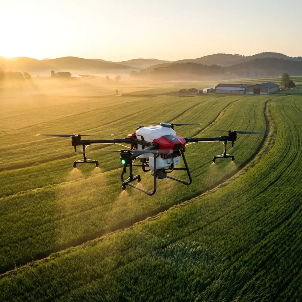
Agras T70P in Broken Terrain: A Field Report on Filming, Precision, and What Actually Matters
META: A field-based expert report on using Agras T70P in complex agricultural terrain, with practical insight on precision flying, filming workflow, sensor discipline, and why repeatable path logic matters.
I have filmed agricultural drones in steep tea plots, terraced citrus blocks, and rice fields split by irrigation channels that looked harmless on a map but became awkward the moment the aircraft lifted. The problem is rarely just the camera angle. It is the aircraft behavior underneath the footage: how steadily it tracks, how predictably it reacts near boundaries, and whether the pilot can trust the machine to do the same thing twice.
That is the lens through which I think about the Agras T70P.
For readers interested in field filming rather than brochure claims, the T70P becomes most interesting when the terrain is untidy. Flat demo pads hide too much. In real work, you are dealing with irregular field edges, tree shadows, elevation changes, wet access roads, and the constant need to document operations clearly enough for farm managers, agronomists, and clients to review what happened. A drone meant for agricultural work is not judged only by payload or route speed. It is judged by whether it remains legible under pressure. Good filming depends on that.
Years ago, one of my most frustrating shoots involved a treatment block cut into narrow sections by retaining walls. The aircraft was capable, but every pass near the transitions created uncertainty in the footage. The line looked clean from one angle, then drifted visually from another because the motion logic was not easy to read. We spent more time explaining the operation than showing it. That is the hidden tax of poor repeatability.
With the T70P, the conversation should be different. Not because the machine makes complexity disappear, but because advanced agricultural filming becomes easier when the aircraft’s movement is consistent enough to tell a coherent operational story. For a professional audience, that matters more than cinematic flair.
The filming challenge in agriculture is not beauty. It is proof.
Many people approach drone filming as if image quality alone carries the job. In field operations, that is backwards. The first purpose of filming is to make the mission understandable. Was the swath width maintained? Did the route hold along the terrace edge? Was there visible spray drift risk near the downwind margin? Did the aircraft behave smoothly enough that nozzle calibration and application consistency can be discussed from the footage with confidence?
This is where the T70P earns attention in complex terrain. An agricultural aircraft working close to crop boundaries has to combine route discipline with stable attitude control. If the platform wanders, pitches abruptly, or makes ugly correction moves, the footage becomes harder to interpret. You can still capture video, of course. But you lose analytical value.
Readers who work around RTK systems already know why centimeter precision and RTK fix rate are not abstract checkboxes. In hillside or fragmented farmland, they affect whether the aircraft’s path appears deliberate or hesitant. For filming, that distinction is huge. A reliable RTK fix rate translates into cleaner visual continuity. Passes line up. Headland turns look intentional. Repeated demonstration flights can be compared without guessing whether the aircraft wandered because of the operator, the signal environment, or terrain-induced instability.
If I am documenting a T70P in a mixed-elevation field, I want viewers to see one thing above all: that the aircraft does not look surprised by the landscape.
What complex terrain teaches you about aircraft logic
One unusual reference in the source material came from a DJI educational drone text describing maze exploration. On pages 209 to 210, the aircraft uses a right-hand rule to navigate an unknown maze, checking wall presence cell by cell with a TOF distance sensor. If the first side is blocked, it rotates and checks the next. When it detects a challenge card, it hovers, flashes a blue LED for 3 seconds, and displays the card number on a matrix screen.
At first glance, that has nothing to do with the Agras T70P. In practice, it tells us something useful about how to think about drones in constrained environments.
Agricultural terrain is often a kind of open maze. Not a maze of walls, but of boundaries: shelterbelts, embankments, utility poles, irrigation structures, and crop rows that create operational channels. The maze example matters because it shows the value of rule-based movement in uncertainty. The drone does not improvise emotionally. It applies a consistent decision structure, checks space with a distance method, and commits to the next move.
That operational significance carries straight into filming a T70P in difficult ground. The better the aircraft’s route logic and obstacle-awareness discipline, the easier it is to produce footage that explains decisions instead of hiding them. When an aircraft approaches a narrow margin and responds with measured, repeatable behavior, the camera can stay wider. That gives the audience context. You are no longer forced into tight shots just to conceal unstable motion.
The 3-second hover behavior in that educational example is also more relevant than it seems. A stable hover is not just a training exercise. In field filming, it is the moment where the viewer reads the machine. Hover quality reveals confidence in positioning, control tuning, and sensor integration. If the T70P can hold itself calmly at key moments during documentation shots, your footage becomes a technical record rather than decorative content.
Precision is visible on camera, even when viewers cannot name it
Many clients do not speak in terms like RTK fix rate or centimeter precision. But they can see the outcome. They notice when adjacent passes hold a uniform visual rhythm. They notice whether the aircraft maintains a believable stand-off near obstructions. They notice whether the application pattern looks composed instead of hurried.
This is one reason I encourage teams filming the T70P to think beyond hero shots. Show the relationship between the aircraft and the field geometry. Let the frame include slope transitions. Include the headland. Show the field edge where spray drift would be a concern. In agricultural documentation, context is evidence.
The T70P is especially relevant here because a serious spraying platform invites serious scrutiny. If you are discussing nozzle calibration, your footage should support that discussion. Did the aircraft maintain consistent posture during the pass? Was the travel speed visually stable? Did the release pattern occur where expected relative to the boundary? These questions become easier to answer when the aircraft’s pathing is dependable.
And when terrain gets more complex, protection standards matter too. A platform associated with an IPX6K-level weather-resistant build philosophy makes more sense in the real agricultural environment than a lightly protected aircraft that needs ideal conditions to stay presentable. Dust, splash, chemical residue, and field moisture are not edge cases. They are the working environment. For filming, durable exterior design has an underrated advantage: you can keep documenting after messy turns and wet landings without treating the aircraft like a museum piece.
Audio cues, startup discipline, and why reliability starts before takeoff
Another source reference, the BLHeli Atmel Rev12.x manual, is not about agricultural drones specifically. It describes PWM-based programming mode entry through beep sequences: one beep at power-up, one when throttle-up is detected, then continuous beeps at full throttle and zero throttle during programming progression. Tail configuration uses right rudder as full throttle and left rudder as zero throttle.
Again, this is not T70P operating guidance. But it highlights a principle too many filming crews overlook: aircraft reliability begins with unambiguous system state awareness.
In practical terms, that means your T70P filming workflow should start with disciplined preflight checks, clear confirmation of mode status, and no ambiguity about what the machine believes it is doing. Experienced operators understand this instinctively. The aircraft may be advanced, but trust is built from simple things: startup consistency, expected responses, stable calibration behavior, and clean handoff from setup to mission.
The operational significance of those beep-sequence references is not the beeps themselves. It is the concept of layered confirmation. In the field, especially in rough terrain, one silent misunderstanding at startup can ruin both the mission and the footage. A good filming session with the T70P begins before the props spin. It begins when the operator, camera lead, and visual observer all know the aircraft status without guessing.
That level of discipline is what separates usable agricultural media from casual drone video.
Filming the T70P where the terrain fights back
When I plan a T70P field report shoot, I usually build around three visual tests.
The first is the contour pass. I want to see how the aircraft presents itself while moving across or along terrain changes. A stable contour pass tells me more than a dramatic close-up ever will.
The second is the constrained-edge sequence. This is where field boundaries, access roads, canals, or tree lines create a narrower operating corridor. Here I am looking for confidence in spacing, not aggression. If the aircraft maintains a clean working relationship to the edge, that will show up immediately in the footage.
The third is the pause-and-read moment. This can be a hover near a waypoint transition, a hold before a pass, or a post-route stop where the audience gets time to judge stability. It is the aerial equivalent of reading someone’s handwriting. Smooth hover behavior suggests the rest of the system is coherent.
In all three tests, the T70P’s value for filming is not only that it can work. It is that its work can be documented in a way that others can evaluate.
That matters to growers and service companies using video as an operational record. It matters to training teams explaining best practice. It matters to agronomy consultants reviewing drift risk, route quality, or coverage patterns after the fact. And it matters to content teams who want to show the aircraft honestly without relying on cinematic tricks.
The camera should respect the operation
One stray source item discussed mobile portrait photography and recommended using portrait mode to keep the subject sharp while softening the background. Oddly enough, that advice translates well to agricultural drone storytelling, though not literally. When filming the T70P, the subject is not just the aircraft. It is the relationship between aircraft, crop, and terrain. If the frame isolates the drone too much, you lose the operational meaning. If the background overwhelms it, the machine becomes a dot with no narrative.
The trick is selective emphasis. Keep the aircraft visually dominant, but preserve enough field structure to show why the movement matters. In other words, create separation without erasing context.
That is how you make footage useful to professionals.
Where the T70P makes life easier
The biggest improvement a capable agricultural platform brings to complex-terrain filming is not spectacle. It is reduced explanation. When the aircraft path is consistent, when positioning is precise, when hover behavior is calm, and when the machine looks built for wet, dirty field conditions, your audience spends less time questioning the basics.
They can move on to the real conversation: application quality, swath width management, drift control, route efficiency, and field-specific decision-making.
That is why the T70P deserves serious attention from teams filming agricultural operations rather than just selling the image of them. In broken terrain, the aircraft has to tell the truth on camera. Precision is not a line in a spec sheet there. It becomes visible behavior.
If you are planning to document the T70P in a difficult field and want to compare shot plans or operational setups, you can message our field team directly. Keep the discussion grounded in the site conditions. Terrain always gets the last word.
My own view is simple. A good agricultural drone should not merely complete a route. It should do so in a way that remains understandable under observation. The references we were given, from rule-based maze navigation with TOF sensing to explicit startup-state confirmation through audio cues, both point toward the same operational truth: repeatability wins. In agriculture, repeatability is safety, efficiency, and credibility rolled together.
And when you are filming the Agras T70P in a field that bends, narrows, climbs, and resists simple geometry, credibility is the whole point.
Ready for your own Agras T70P? Contact our team for expert consultation.