
Agras T70P for Coastal Delivery and Field Operations
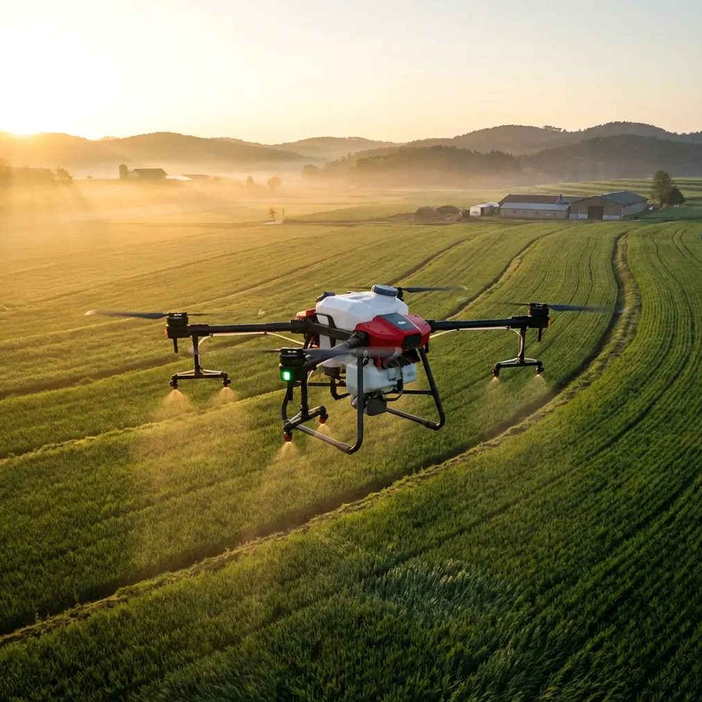
Agras T70P for Coastal Delivery and Field Operations: What Actually Matters
META: Technical review of Agras T70P operations in coastal environments, with practical insight on precision, connectivity, workflow design, and why low-altitude logistics maturity changes deployment strategy.
The Agras T70P sits at an interesting intersection. On paper, it belongs to the agricultural UAV class. In practice, anyone planning operations along coastlines quickly discovers that the aircraft itself is only half the story. The real question is whether the surrounding workflow—navigation reliability, operator interface, payload consistency, and low-altitude logistics readiness—can hold up in a place where salt air, shifting wind, and fragmented delivery or service routes expose every weakness.
That is why the most useful way to evaluate the T70P is not as a spec sheet object, but as part of a broader low-altitude operating system.
A recent development in China helps frame the point. Shansong, known for urban instant delivery, received investment from Hangzhou Low Altitude Company to jointly build out drone delivery services. That matters beyond one partnership. It signals a market transition from isolated drone trials to an ecosystem model built on transport capacity networks, order operations, and urban fulfillment experience. In plain terms: low-altitude aviation is becoming less about a single aircraft and more about whether the operator can integrate dispatch, route logic, and execution at scale.
For an Agras T70P operator working coastal territory, that shift is highly relevant.
Why a coastal mission profile is harder than it looks
Coastal operations punish inconsistency. Wind gradients change across seawalls, estuaries, terraces, and open plots. Corrosion pressure is constant. GNSS conditions may be good in open areas yet suddenly less predictable around port structures, greenhouses, warehouses, or mixed-use settlements. And if you are supporting agriculture near the shoreline—orchards, vegetables, aquaculture-adjacent facilities, or shelterbelt management—your margins for spray drift and placement accuracy get tighter, not looser.
This is where terms like swath width, nozzle calibration, RTK fix rate, and centimeter precision stop being marketing vocabulary and become operational controls.
The T70P’s value in these conditions comes down to whether it can maintain uniform application while the operator preserves decision quality under pressure. A wide swath is only useful if edge definition stays controlled. High payload productivity only helps if the aircraft can repeat lines cleanly. Centimeter-level positioning only earns its keep if the workflow around it is fast enough to keep the machine moving.
That last point often gets ignored.
The hidden bottleneck is not flight power. It is interface discipline.
One of the most practical reference points in the source material comes from the DJI TT educational drone documentation. At first glance, a classroom platform seems far removed from an Agras T70P. It is not. The TT material shows a stripped-down truth about UAV operations: a drone mission succeeds or fails through connection architecture, interface clarity, and activation discipline before it ever becomes a flight performance story.
A few details stand out.
The TT documentation notes that when the expansion module is attached, the module must be switched to single-machine mode, and the WiFi name changes to an RMTT-XXXX pattern visible on the rear label of the module. Without the module, the aircraft uses a Tello-XXXX WiFi identifier found on the inside battery slot label. The same guide also warns that first-time startup requires activation through the app; otherwise the aircraft cannot take off normally.
Those sound like small training notes. They are not small at all.
They illustrate three operational truths that carry directly into larger commercial platforms like the Agras T70P:
Connection state must be unambiguous.
In the field, especially near coastlines where crews may be dealing with glare, moisture, and time pressure, operators need immediate certainty about whether they are connected to the right aircraft and the right control mode.Every added module or system layer has a performance tradeoff.
The TT guide explicitly states that flying without the expansion module can improve performance and extend battery endurance. That principle scales upward. On a professional aircraft, every accessory, sensor package, or workflow add-on should justify itself. More capability is not always better if it complicates execution or reduces endurance in a marginal environment.Preflight digital readiness is non-negotiable.
If activation or authorization is incomplete, the aircraft does not perform. Commercially, this extends to firmware state, RTK service status, boundary files, mission uploads, and controller-device synchronization.
For T70P users, that means the best operators are not just skilled pilots. They are process engineers.
What separates the T70P from weaker deployments
A serious coastal deployment needs more than lift and spray capacity. It needs repeatable precision under changing conditions. This is where the broader history of multirotor development in the academic and commercial world gives useful context.
The reference lecture on multirotor history identifies the post-2013 period as an explosion phase, with research increasingly focused on intelligence and swarm capability. It also points to a 2015 Nature review by Floreano and Wood on the science and future of small autonomous civilian drones, and highlights the larger trendline: hardware miniaturization, stronger onboard computing, more powerful motors, improved battery energy density, and integrated user experiences fundamentally changed what multirotors could do.
That history matters because the T70P is the product of that maturity curve. It is not just a bigger drone. It belongs to a generation shaped by smarter control, tighter integration, and better operator feedback loops. Compared with many lower-end or transitional platforms, that usually translates into a practical edge in three areas:
1. Better mission repeatability
A capable agricultural platform should hold lines consistently enough that nozzle calibration and swath width planning produce predictable field results rather than hopeful estimates. In coastal work, this reduces overlap waste and helps contain spray drift near sensitive edges.
2. Higher-value autonomy
Autonomy is only useful if it reduces operator burden without hiding mission risk. The lesson from a decade of multirotor evolution is that smart systems should clarify decisions, not bury them. A platform that supports strong route fidelity and reliable RTK behavior has a measurable advantage over aircraft that force the pilot to constantly compensate.
3. More coherent human-machine interaction
The TT training document gives a surprisingly vivid example here. Once connected, the tablet displays a live forward view and a top bar showing takeoff/landing, flight mode, settings, battery level, WiFi status, Bluetooth status, flight speed, flight altitude, playback, photo/video toggle, and capture controls. That interface design principle—put the critical state in front of the operator—is foundational. On a platform like the T70P, clean presentation of status data is not cosmetic. It is how you keep a mission stable when environmental complexity rises.
Coastal delivery is not the same as crop spraying—but the operating logic overlaps
The user scenario here references delivering along coastlines, which may sound outside the Agras T70P’s core agricultural identity. But the overlap is stronger than many assume.
A coastline operation often involves dispersed endpoints, variable weather windows, and route segments where ground access is slower than aerial movement. The Shansong-Hangzhou Low Altitude Company collaboration is relevant precisely because it shows where the industry is heading: from standalone aircraft operations toward integrated low-altitude service networks.
Shansong’s strength came from years of built-out transport capacity, order management, and city fulfillment experience. That is the operational backbone drone programs usually lack. A capable aircraft without a dispatch and execution architecture becomes an expensive bottleneck. A mature fulfillment system with the wrong aircraft becomes a reliability problem. You need both.
For T70P-adjacent deployments in coastal zones—whether supporting agricultural material movement, site inspection logistics, or time-sensitive service runs near remote plots—the lesson is simple: aircraft productivity should be designed into a logistics stack, not treated as an isolated capability.
If you are mapping out such a deployment and need a practical discussion around field workflow, this direct line is often the fastest way to compare options: message a coastal UAV operations specialist.
Where RTK fix rate and centimeter precision become real
A lot of operators talk about centimeter precision as though it automatically guarantees good outcomes. It does not. Precision only creates value when the rest of the mission system is tuned to exploit it.
On the T70P, high positioning quality matters most in five specific ways:
Boundary integrity
Coastal fields and service corridors are rarely neat rectangles. They bend around irrigation cuts, embankments, retention ponds, access roads, and shoreline buffers. Better positional confidence helps preserve margins and reduces accidental overreach.
Consistent swath spacing
When RTK fix rate is stable, line-to-line spacing becomes more dependable. That protects application quality and reduces under-treatment or double-application in windy conditions.
Turn efficiency
At the headland or route endpoint, every clean turn saves time and reduces pilot correction workload. On fragmented coastal parcels, those seconds compound across a day.
Obstacle margin management
Even where mission planning is automated, real-world obstacles—utility poles, netting, trees, low structures—demand exact path control. Precision is a safety and productivity factor at the same time.
Data confidence
If the aircraft is paired with multispectral or field analysis workflows elsewhere in the operation, positioning quality helps preserve comparability between application records and agronomic observations.
Spray drift control starts before the aircraft lifts
The coastal environment makes spray drift the defining technical challenge for many T70P operators. Equipment quality helps, but no aircraft can solve bad process.
The most effective workflow starts with nozzle calibration. Not because it is glamorous, but because it converts the aircraft from a flying platform into a measurable application system. Calibration determines whether your intended output matches reality. In a windy shoreline setting, a calibration error combined with environmental drift can stack into a serious miss very quickly.
The T70P should be judged here against competitors not by who claims the biggest number, but by who allows the operator to hold a stable pattern with the least correction. That is where stronger integration usually wins. A well-tuned aircraft/controller ecosystem can outperform a nominally similar competitor simply because the workflow is cleaner and the pilot spends less cognitive energy chasing state.
This is exactly the lesson hidden in the TT training material’s interface layout. Showing speed, altitude, connection state, and live view together is operationally significant because it compresses decision time. On larger commercial aircraft, the same principle enables better drift management, especially when the operator must react to changing gusts while preserving application uniformity.
The maturity of the low-altitude economy changes procurement logic
The Hangzhou investment story is easy to read as business news and nothing more. That would miss the point.
When a city’s low-altitude economy begins to mature, aircraft selection changes. Buyers and operators stop asking only, “What can this drone do?” They begin asking, “What can this drone support inside a service network?”
That is the right lens for the Agras T70P.
In a coastal operation, the best platform is not necessarily the one with the loudest feature set. It is the one that can plug into a repeatable workflow involving route planning, dispatch timing, maintenance discipline, battery rotation, weather judgment, and data traceability. The stronger the ecosystem around low-altitude logistics becomes, the more valuable an aircraft is when it behaves predictably inside that system.
That is why the T70P deserves attention. Not because it exists in isolation, but because the market around it is finally catching up to what capable UAV hardware has needed all along: infrastructure, process, and operational maturity.
Final take
The most credible case for the Agras T70P in coastal work is not a simplistic one. It is a systems argument.
The multirotor sector has spent more than a decade moving toward smarter, more integrated aircraft. The academic side pushed intelligence and autonomy. The commercial side improved user experience and practical deployment. The latest low-altitude logistics partnerships show the ecosystem layer is now maturing too.
Set against that backdrop, the T70P should be evaluated on the details that actually govern results: RTK fix rate stability, centimeter-precision path repeatability, nozzle calibration discipline, swath width control, interface clarity, and how well the platform fits into a real dispatch-and-execution workflow.
Even the TT educational drone reference reinforces the point. A simple requirement like selecting the correct single-machine mode, identifying the right WiFi name, or completing first-use activation can decide whether a mission starts cleanly or fails before liftoff. Scale that lesson up, and you get the truth of commercial UAV operations: the aircraft matters, but the workflow matters more.
For operators delivering services along coastlines, that is the difference between owning a drone and running an effective low-altitude operation.
Ready for your own Agras T70P? Contact our team for expert consultation.