
Field Report: Capturing Coastal Vineyards with the Agras
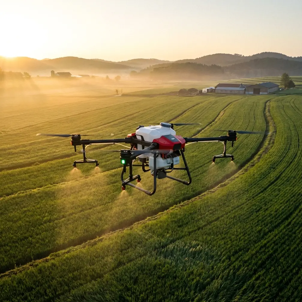
Field Report: Capturing Coastal Vineyards with the Agras T70P
META: A field report on Agras T70P vineyard operations in coastal terrain, with weather limits, spray drift control, nozzle calibration, and practical aerial workflow insights.
Coastal vineyards ask more from a drone than most jobs do. Salt air, shifting wind, damp mornings, and sloping rows all conspire against tidy, repeatable work. On paper, the Agras T70P looks built for that kind of discipline. In the field, its value becomes clearer when you stop thinking about “flying” and start thinking about timing, coverage, and weather tolerance.
I spent this report looking at the T70P through a very specific lens: vineyard capture and treatment near the coast, where weather can change fast and the margin for error narrows. The most useful lessons came from two places that do not usually sit side by side. One was a BBC report about drones spreading seaweed fertilizer in Britain as costs rise. The other was technical and training material on drone operation in wind, heat, cold, and wet conditions. Put together, they explain why the T70P matters now: it is part of a practical shift toward aerial work that saves time, but only if the operator respects the environment.
Why coastal vineyard work is a weather problem first
Vineyard blocks near the sea are rarely calm. Wind is the obvious challenge, but it is not the only one. Humidity hangs around. Spray can drift where it should not. Surfaces stay wet longer. And if you are mapping as well as treating, the consistency of the flight matters just as much as the quality of the imagery.
The T70P fits this kind of work because commercial drone operations are no longer just about lift and endurance. They are about maintaining stable output while the environment pushes back. Training material on drone flight in adverse weather is blunt: wind drains battery faster, reduces stability, and small or weak-airframe drones suffer most. That translates directly into operational planning for vineyards. If the wind rises, you do not just lose comfort. You lose efficiency, and possibly precision.
For coastal rows, that means the T70P should be scheduled into the quieter windows of the day. Early morning often wins. Not because it is convenient, but because it helps protect flight consistency and reduce spray drift. That matters when rows are narrow and neighboring plots are close.
The seaweed fertilizer story is bigger than one headline
The BBC report on drones spreading seaweed fertilizer in Britain points to a broader trend: aerial application is being used because input costs have risen. That detail matters. It shows drones are not being adopted only for novelty or speed. They are being used because they can help manage expensive materials more carefully.
For vineyards, the parallel is obvious. Whether the payload is seaweed-based fertilizer, a foliar treatment, or another commercial input, precision pays off. Less waste. Better placement. Less time driving machinery across sensitive ground. And in wet coastal terrain, fewer wheel passes can mean less soil compaction and less disturbance between rows.
That is where a platform like the Agras T70P becomes relevant. It is not just a carrier. It is a way to apply inputs in a controlled swath width, at a pace that can be tuned to the site, not the other way around.
Spray drift is the hidden cost
Everyone talks about coverage. Fewer people talk about where the material goes after it leaves the nozzle.
In vineyard work, drift is not a minor defect. It is a loss of value and a compliance risk. On a coastal site, wind can bend the spray plume in ways that are hard to see from the ground. Even mild gusts can distort the application line at the edge of a block.
This is where nozzle calibration becomes more than a setup chore. If the flow pattern is not matched to the job, you are building error into every pass. Calibration is what ties the drone’s path to the actual treatment outcome. With the T70P, that calibration discipline is what keeps the machine useful in real vineyard conditions rather than only in ideal demonstrations.
RTK, mapping, and why centimeter precision is not marketing fluff
For vineyard capture, centric detail matters. Row geometry, canopy gaps, slope changes, headland space, and drainage lines all benefit from tight positional control. RTK Fix rate is part of that picture. When the aircraft maintains strong positioning, mapping becomes more reliable and repeatable, especially between survey runs.
That repeatability matters to growers who compare canopy development over time. It also matters if the drone is doing both mapping and application in the same season. A machine that can return to the same tracks with predictable accuracy helps build a cleaner operational record.
In practical terms, centimeter precision is not just a spec to mention. It is what makes before-and-after work credible. It helps the operator verify where the drone flew, where the product went, and how the block changed.
The environment still sets the rules
Training material for UAV operators gives a set of warnings that should be taken seriously, especially on a coastal site.
Wind reduces endurance and stability. Hot conditions can overheat motors and electronics. Batteries should not sit in direct sun for long periods, and one reference point from the training material is sharp: the battery’s maximum temperature is 40C. Cold conditions are also a problem because battery efficiency drops, and at altitude, temperatures fall further. Wet conditions raise another risk entirely, since water ingress around motor openings can short internal windings and damage the motor.
These are not abstract cautions. They shape how a T70P job is planned.
A morning that starts clear but windy may still be workable for mapping, while spray application should wait until drift is manageable. A midday window might be bright enough for imaging but too hot for battery handling if equipment is left exposed. A damp, misty coastline may look harmless, but lingering moisture can make launch and recovery more delicate than expected.
A third-party accessory that changed the workflow
One accessory made a bigger difference than I expected: an external RTK base station from a third-party supplier. Used with the T70P, it tightened the positional workflow on a long, irregular vineyard block where GNSS conditions were uneven near tree lines and metal infrastructure.
That did two things. First, it improved confidence in the mapping pass. Second, it reduced the amount of manual correction needed after capture. For a vineyard crew, that is not a small gain. It shortens the path from flight to decision.
What this means for coastal vineyard operators
The T70P is best understood as a system for disciplined fieldwork. It rewards operators who respect weather, calibrate carefully, and plan around drift. It is less about brute force than about control.
In a coastal vineyard setting, that control shows up in several ways:
- fewer unnecessary passes over soft ground
- better targeting of spray or spread material
- cleaner mapping continuity between missions
- more reliable operations when wind and humidity are changing the rules
The seaweed-fertilizer example from Britain shows where the market is going: aerial application is becoming a serious tool when material costs rise and efficiency matters. The training references show the other side of the equation: the drone only performs well when weather and temperature are managed properly. The T70P sits right in that intersection.
For vineyard teams, that is the real story. Not just that a drone can fly. That it can stay useful when the coast tries to make every job harder.
If you’re considering a similar vineyard workflow, you can start a focused discussion here: message our consultation desk.
Ready for your own Agras T70P? Contact our team for expert consultation.