
Agras T70P Best Practices for Forest Work in Complex Terrain
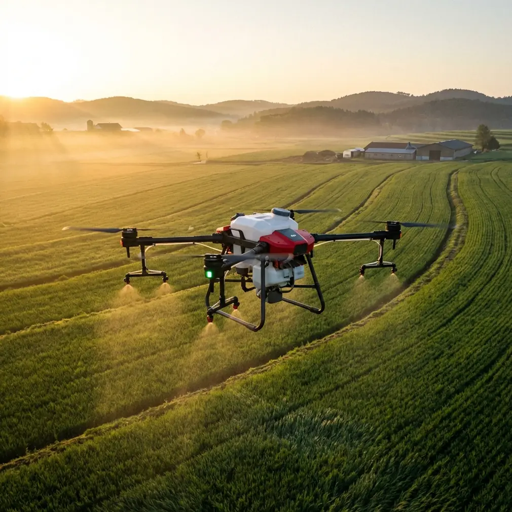
Agras T70P Best Practices for Forest Work in Complex Terrain
META: Practical Agras T70P guidance for forest operations in difficult terrain, including precision workflow, spray drift control, battery planning, RTK considerations, and obstacle-aware flying.
Forest work exposes every weakness in an agricultural drone program.
Open farmland is forgiving. Forest edges, fragmented canopy, steep slopes, narrow clearings, shifting wind, and uneven GNSS conditions are not. If you are preparing to use the Agras T70P around wooded tracts, plantation blocks, shelterbelts, or mixed agroforestry zones, the real question is not whether the aircraft can fly the mission. The question is whether your workflow is disciplined enough to keep coverage consistent when the terrain stops behaving like a field.
That is where the T70P discussion gets interesting. Not because it is simply a large spraying platform, but because forest-adjacent operations demand a tighter integration of flight control, sensor trust, battery strategy, and application accuracy than most operators expect on day one.
I’ve seen this first-hand in hilly timber margins where a route looked clean on the planning screen, then turned messy once the drone dropped below the ridge line and the canopy began affecting signal quality. On one flight, a startled deer broke from brush near a replanting corridor just as the aircraft approached a narrow turn. The drone’s sensing and route discipline mattered in that moment, not brochure claims. In complex terrain, small moments decide whether the job stays efficient or becomes a recovery exercise.
Start with the terrain, not the tank
The biggest mistake in forest spraying or imaging support work is planning from the aircraft outward. Start from the site inward instead.
Agras T70P operations near forests are shaped by four variables:
- canopy interruption
- slope transitions
- wind behavior at different heights
- limited takeoff and recovery space
These variables directly affect swath width, drift risk, and route stability. A wide effective path on flat, open ground often becomes unrealistic when tree lines create turbulent air pockets. In a forest corridor, even a small crosswind can push droplets off target, especially near edge vegetation where airflow changes abruptly.
That is why nozzle calibration is not a maintenance detail. It is mission design. If output is tuned only for nominal conditions, the result in complex terrain is usually over-application in sheltered pockets and under-coverage on exposed sections.
Before the first productive sortie, verify your delivery rate against actual target vegetation and not just the default profile. In mixed forestry or orchard-edge work, the correct pattern depends on how dense the vegetation wall is, how much penetration is needed, and whether drift-sensitive plants or waterways sit downwind.
RTK is valuable, but you still need to think like a pilot
Centimeter precision is one of the reasons operators move toward high-end platforms for structured agricultural work. In forest settings, that precision is still useful, but only when expectations are realistic.
RTK fix rate can degrade near tall tree stands, ravines, and steep embankments where satellite visibility changes across the route. The pilot who treats RTK as a guarantee will eventually learn otherwise. The better approach is to think of RTK as a performance multiplier in the portions of the mission where geometry supports it, and to build margins for the segments where it does not.
Operationally, this means:
- placing the base station where sky visibility is strongest
- avoiding route turns directly beside dense canopy when possible
- reviewing terrain-following behavior before running a full-load mission
- testing a short lane first to confirm position stability near the worst obstruction zone
In practical terms, centimeter precision matters most at overlap boundaries, treatment edges, and return lines. If the fix quality fluctuates and the mission plan assumes perfect consistency, skips and doubles are more likely. In forests and plantations, those errors are harder to see from the ground than in row crops, so post-flight verification becomes more important.
Battery strategy is now part of mission quality
This matters more than many teams admit.
One of the more interesting developments in the drone sector comes from Factorial Energy, which recently announced partnerships across three continents to integrate next-generation solid-state batteries into drones. The stated targets are clear: better endurance, higher power output, and stronger cold-weather performance.
Why should an Agras T70P operator care, even if that battery tech is not in your aircraft today?
Because the battery problem defines what kind of work is comfortable versus stressful in complex terrain. Forest missions punish weak energy planning. Climb-outs, repeated acceleration near elevation changes, and careful obstacle-aware routing all demand power consistency. When temperatures drop, battery behavior becomes even more consequential. Cold-weather performance is not a lab topic if you launch near wooded highland blocks in the early morning.
The significance of this industry shift is simple: better batteries will eventually allow agricultural operators to keep more of their payload efficiency in real conditions instead of ideal ones. Endurance gains are obvious, but power output stability is just as important. In a heavy-lift agricultural drone, voltage sag at the wrong moment affects route confidence, spray continuity, and safe recovery margins.
Until those next-generation packs become mainstream in ag platforms, run your T70P missions with conservative battery logic:
- avoid stretching flights to theoretical limits
- reserve extra power for uphill returns or evasive rerouting
- expect colder microclimates under dense canopy margins
- separate “enough to finish the line” from “enough to finish the line safely”
There is a useful lesson buried in older training literature too. A DJI training document for the TT education drone notes that certain intelligent flight modes should only be used when battery level is above 50%. That document is about a very different aircraft, but the operational principle carries over. Automation is never an excuse to become casual about remaining energy. When the drone is executing higher-order behavior, battery reserve becomes part of the safety envelope, not just the mission clock.
Drift control matters more at the forest edge than in the middle of the field
Spray drift is not evenly distributed across a mission area. The highest-risk zones are usually transition zones.
At the boundary between open ground and dense trees, airflow rolls, lifts, and redirects in ways that are easy to underestimate from the launch point. That means your T70P setup should not be static from one property type to the next. If you run identical application assumptions across open cropland, tree-lined roads, and young forest blocks, consistency suffers.
Here is the practical workflow I recommend:
1. Walk the edges before you map them
Do not rely solely on satellite imagery. Edge density, understory growth, and recent clearing work all affect downwash interaction and drift potential.
2. Adjust route direction to the wind, not the shape of the parcel
A neat geometric pattern can be the wrong biological pattern. In forests, route orientation should reduce drift escape, especially near waterways or buffer zones.
3. Verify nozzle calibration against the actual target
Fine droplets may improve certain coverage goals, but they also raise drift sensitivity. In sheltered lanes, they behave differently than on exposed ridges.
4. Shorten assumptions about effective swath width
Theoretical swath width often shrinks near obstacles and vertical vegetation. Build overlap intentionally rather than hoping the edge behaves like the center.
5. Inspect results in sections
A forest mission should be audited by terrain segment: open strip, tree edge, slope face, interior lane. One blanket judgment misses the truth.
Complex terrain exposes weak takeoff and recovery habits
Many operators obsess over flight lines and underprepare for launch and landing. Around forests, that is backwards.
Uneven ground, roots, soft soil, and narrow staging spaces complicate every cycle. If your turnaround area is marginal, efficiency disappears quickly. More importantly, rushed recoveries increase the chance of rotor contact with branches or debris.
This is one place where lessons from training drones are surprisingly useful. The TT educational platform includes simplified modes such as throw launch, auto-hover behaviors, and a “bounce” mode that keeps the aircraft oscillating between roughly 50 and 120 centimeters above the takeoff surface. That drone is not an agricultural workhorse, but the training philosophy behind those functions is worth paying attention to: repeatable low-altitude control builds operator judgment.
For T70P crews, the takeaway is not to imitate those modes. It is to train deliberate close-ground handling until every launch and recovery is boring. In forest operations, boring is the goal. If the team only feels polished at cruising altitude, they are not actually polished.
I usually recommend dry runs with no application load in the exact kind of staging area the real mission will use: sloped clearings, narrow road cuts, or patchy field margins. Practice the awkward spaces, not just the perfect ones.
Use sensors, but don’t outsource judgment to them
Obstacle sensing has changed what is possible around trees and broken terrain. It has not changed the fact that vegetation is inconsistent.
Branches protrude. Vines hang. New growth appears between visits. Fog, glare, and layered background textures can also complicate how confidently a system reads the environment. The wildlife encounter I mentioned earlier drove that home. The aircraft handled the unexpected movement without drama, but the reason the mission stayed clean was that the route had already been built conservatively. Sensors helped; planning prevented.
That distinction matters.
If the T70P is operating near forested land, use its sensing stack as a second line of defense, not your first. Build turn radii with space. Avoid last-second elevation changes beside tree walls. Keep visual observers where terrain blocks the pilot’s full view. If the route only works when every sensor performs perfectly every second, the route is too aggressive.
Forestry-adjacent jobs are often policy-shaped, not just technology-shaped
There is a useful policy signal in older Chinese agricultural aviation documents. As far back as 2015, Henan identified agricultural aircraft as a pilot category for agricultural machinery subsidy programs, with the goal of accelerating efficient plant-protection mechanization and improving pest-control capacity.
That detail may sound historical, but it tells us something current and practical: agricultural drone adoption has long been tied to system-level thinking, not just aircraft capability. In other words, spraying platforms like the Agras line succeed when they fit a broader operational framework that includes training, service structure, and agronomic discipline.
For forest-edge and plantation operators, the significance is straightforward. The T70P should be treated as one part of a mechanized plant-protection workflow, not a standalone shortcut. If your data capture, route planning, refill procedure, calibration routine, and post-treatment assessment are weak, a larger platform only amplifies inconsistency.
What a strong T70P forest workflow looks like
A capable team tends to follow a sequence like this:
Pre-site review
Study terrain contours, canopy interruptions, access tracks, refill points, and likely signal-shadow areas.
On-site validation
Confirm launch zones, identify drift-sensitive boundaries, and watch the wind at multiple heights rather than assuming the surface reading tells the whole story.
Precision setup
Check RTK conditions, verify fix stability, and modify route geometry where canopy or slope creates risk.
Application tuning
Set realistic swath width, calibrate nozzles for target vegetation, and avoid overconfidence in default profiles.
Conservative battery management
Account for climbs, detours, cooler microclimates, and contingency return power.
Segmented quality control
Inspect outcome by terrain class, not just by total acreage treated.
If you are building this kind of workflow and want a field discussion around route planning or setup choices, you can message our technical team directly here.
Should multispectral be part of the picture?
In some forest-adjacent operations, yes. Not always for the spraying aircraft itself, but certainly in the broader program.
Multispectral mapping can help identify stress gradients, drainage-related disease patterns, and treatment priority zones before the T70P is sent in. That matters in complex terrain because uneven moisture, variable sun exposure, and localized canopy density often create patchy conditions that a blanket treatment plan fails to respect.
The key is to let the sensing data shape application strategy rather than collecting imagery for its own sake. Multispectral information is most useful when it changes where you fly, how much you apply, or what you skip.
The real advantage is not size. It is discipline.
The Agras T70P earns its place in difficult terrain when operators stop treating it like a bigger field drone and start treating it like a precision system working inside a messy environment.
Forest work rewards crews that think in margins: margin in battery reserve, margin in route spacing, margin in swath assumptions, margin in obstacle clearance. It also rewards teams that understand the difference between advertised capability and repeatable field performance.
The industry’s push toward better batteries, including solid-state development aimed at endurance and cold-weather gains, will eventually reduce some of today’s operational compromises. Policy history shows agricultural aviation has long been supported where it demonstrably improves mechanized plant protection. Training principles from even small educational drones remind us that battery reserve and controlled low-altitude handling still matter. Put together, these signals point in one direction: the best T70P results in forests will come from operators who combine advanced hardware with old-fashioned procedural rigor.
That combination is what keeps coverage even, drift controlled, and sorties predictable when the ground stops being simple.
Ready for your own Agras T70P? Contact our team for expert consultation.