
Agras T70P Capturing Tips for Forest Terrain
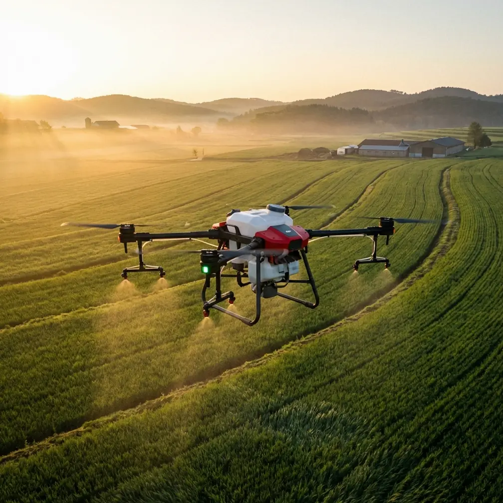
Agras T70P Capturing Tips for Forest Terrain: Reading Attitude, Managing Range, and Flying Smarter in Tight Canopies
META: Practical Agras T70P field guidance for forest operations, including antenna placement, attitude angle interpretation, obstacle awareness, RTK stability, and terrain-focused flight planning.
Forest work exposes every weak habit in a drone operation.
Open farmland forgives a lot. A forest edge does not. Sloped ground, broken canopy lines, trunks that appear late in the frame, and signal-blocking terrain all pile pressure onto the aircraft, the pilot, and the mission plan. If you are preparing to use an Agras T70P in complex woodland terrain for civilian capture, terrain observation, vegetation assessment, or forestry workflow support, the most useful mindset is not “fly bigger and faster.” It is “measure how the aircraft behaves when the environment gets awkward.”
That distinction matters because forest operations are rarely limited by headline specs alone. They are limited by control authority, visibility, positioning reliability, and how quickly the aircraft can sense and respond when its path stops being simple.
The reference material behind this article points to two ideas that deserve more attention from serious operators. First, attitude angle is not just a telemetry number sitting in the corner of the screen. It is a live indicator of how hard the aircraft is working in a given direction of travel. Second, high-speed obstacle perception only becomes useful when the system can process information fast enough to matter in clutter. One cited vision approach achieved obstacle detection at 120 frames per second on a conventional mobile CPU, specifically because short reaction windows demand short sensing cycles. For forest flying, that principle translates directly: the tighter the environment, the less value there is in delayed awareness.
Start with attitude angle, not with speed
A technical teaching document in the source material frames “maximum attitude angle” in a very practical way: ignore the sign and focus on the largest pitch or roll angle the drone reaches during motion. That sounds academic at first, but in forest terrain it becomes operationally useful.
Why? Because maximum attitude angle tells you how aggressively the aircraft must lean to produce or maintain a movement. In plain terms, a drone that has to pitch or roll harder is spending more of its margin on motion control. That reduces comfort around branches, slope transitions, and sudden avoidance corrections.
The same source suggests testing the aircraft at different speeds while moving in diagonal directions such as left-front, left-rear, and right-rear, and also during circular motion on a horizontal plane. This is exactly the sort of thinking T70P operators should adopt before taking on wooded terrain.
A forest mission is full of diagonal inputs. You are not always flying clean forward lines. You may need to slide across a hillside, retreat backward from a canopy opening, or arc around an obstacle while maintaining a stable view of the target area. Each of those maneuvers loads the aircraft differently.
If you only test straight-line forward flight, you learn almost nothing about how the T70P will feel when a route bends around trees or terrain.
What to look for in practice
Run controlled test segments in a safe open area that resembles your forestry site as closely as possible, but without the collision risk. Compare:
- forward-left movement at low, medium, and higher working speeds
- backward-diagonal movement, where pilot orientation errors are more common
- broad circular passes at fixed altitude
- transitions from hover into lateral motion and back to hover
Watch the aircraft’s peak pitch and roll values during each profile. Do not fixate on one number. Look for patterns.
If maximum attitude angle climbs sharply with modest speed increases, that is a clue. The route may still be technically flyable, but you are entering a part of the envelope where small disturbances carry bigger consequences. In forest terrain, that can mean more drift at the edge of the canopy, less stable imaging geometry, or rougher corrections when terrain rises unexpectedly.
This is one reason swath width planning should never be isolated from aircraft handling. A wide pass may look efficient on paper, but if the terrain forces repeated aggressive corrections, narrower and cleaner lines often produce better data and safer operations.
Why diagonal behavior matters in forests
Most pilots naturally think in forward travel. Forests force side logic.
When moving along a ridgeline or tracing a stand boundary, the aircraft often approaches the subject from an angle rather than head-on. In those moments, roll demand and pitch demand can combine in ways that feel different from straight flight. The source material’s suggestion to explore movement toward left-front, left-rear, and right-rear directions is valuable because it reveals directional asymmetry in real operation.
That asymmetry may come from wind, load distribution, controller tuning, or even how the pilot’s route geometry interacts with terrain.
For a T70P mission in complex woodland, this has three direct benefits:
Better route design
If one diagonal profile consistently generates higher maximum attitude angles, redesign the route to reduce repeated use of that motion where possible.Cleaner capture results
Large attitude excursions can affect image consistency, overlap, and target framing. If you are building forestry records or terrain reference sets, smoother motion is usually more valuable than raw pace.More realistic safety margins
A route that feels comfortable over open land may become unforgiving once trunks, branches, and slope-induced turbulence close in around the aircraft.
Circular motion is not a classroom exercise
The source also recommends examining maximum attitude angle during circular motion at different speeds. For forest work, that is far from theoretical.
Circular or arcing flight shows up anytime you reposition around a stand, orbit a landmark, or maintain visual context around irregular terrain. In forests, circular movement tests whether the aircraft can hold stable curvature without exaggerated lean. That matters because obstacles rarely line up in neat rows.
If the T70P must sustain strong roll or pitch during a turning segment, the onboard sensing, pilot workload, and link quality all come under more stress at once. It also affects how reliably the aircraft can hold a desired stand-off distance from trees or steep embankments.
A practical takeaway: if your circular tests show sharp rises in maximum attitude angle as speed increases, dial back. The gain in coverage rate is usually not worth the loss in controllability and margin.
Obstacle perception: speed only helps if awareness keeps up
The second reference is not about the T70P specifically, but its lesson is highly relevant. The cited stereo vision work achieved 120 fps obstacle detection onboard and did so because high-speed navigation in clutter requires fresh environmental data, not stale estimates. The authors also describe operation at over 20 MPH, or about 9 m/s, close to obstacles.
Forests are clutter. That is the connection.
Even if your T70P is not flying at that exact speed or using that exact sensing stack, the principle stands: when operating near trunks, branches, poles, or uneven canopy margins, delayed perception is expensive. Short exposure times and fast update rates reduce motion blur and preserve reaction time.
For civilian forestry missions, this means you should treat obstacle sensing as one part of a wider system, not as permission to press speed in dense terrain.
What this changes operationally
- Keep capture speed proportional to visibility, not just confidence.
- Reduce speed before entering visually noisy zones such as mixed canopy edges.
- Assume that thin branches and irregular trunks deserve more margin than open-field obstacles.
- Review whether your mission profile gives the aircraft enough time to detect, classify, and respond before the obstacle fills the path.
A T70P used for forest capture should be flown with the understanding that obstacle-rich terrain compresses every decision window.
Antenna positioning advice for maximum range
Signal performance in forests is often misunderstood. Pilots blame the drone when the real problem is geometry.
Trees absorb and scatter radio energy. Hills block line of sight. Wet foliage makes it worse. Antenna placement is therefore not a minor setup detail. It is often the difference between a stable control link and a mission that becomes tentative halfway through a slope run.
Here is the field rule I give teams: place the controller antennas so their broadside faces the aircraft, and avoid aiming the antenna tips directly at it. Most drone antennas radiate strongest off the sides rather than from the ends. In practice, that means adjusting the antenna panels or rods to present the strongest face toward the aircraft’s likely operating zone.
For forest terrain, add three more habits:
Stand above local clutter when possible
A few meters of elevation at the pilot position can improve line-of-sight dramatically.Do not let your body block the link
Turning your torso between the controller and aircraft is enough to weaken reception in marginal conditions.Align for the mission corridor, not for takeoff only
If the aircraft will move along a valley or behind a tree line, orient your setup to the highest-risk segment, not the launch point.
If you need a field checklist for controller orientation and site setup, this quick T70P range note is a practical place to ask for one.
RTK fix rate and centimeter-level positioning in canopy-adjacent work
Forest operations are where positioning claims meet reality.
Centimeter precision is valuable, but under partial canopy or near steep terrain, RTK stability can fluctuate. That is why I recommend watching RTK fix rate as a quality indicator, not just checking whether RTK is technically enabled. An intermittent fix can still leave a mission with uneven spacing, drift in repeat passes, or inconsistent geotag confidence.
This is especially relevant if your T70P workflow supports repeatable capture lines, vegetation monitoring, or correlation with multispectral datasets gathered by another platform. If one pass is held with strong RTK integrity and the next is not, your downstream comparison becomes noisier than it needs to be.
Practical steps:
- establish your base or correction source where sky visibility is strongest
- avoid launching from positions boxed in by tall trunks or cliff walls
- check fix stability before entering the denser portion of the route
- if fix quality degrades, shorten the mission block rather than forcing the full area in one run
A stable RTK solution does not eliminate all forest problems, but it reduces the navigation burden when terrain and canopy already consume enough of your margin.
Spray drift, nozzle calibration, and why they still matter in “capture” planning
Even when the primary task is observation or data capture, many Agras operators come from application backgrounds. That experience helps, but only if it is translated correctly.
Spray drift awareness teaches respect for microclimate. In forests, the same localized airflow that can move droplets off target can also nudge the aircraft off an intended line, especially near canopy gaps and slope edges. Nozzle calibration, meanwhile, trains crews to value measured output over assumption. Carry that habit into capture missions: verify actual route spacing, altitude behavior, and overlap instead of trusting nominal plan values.
This is where the T70P operator who thinks like an agronomy technician often outperforms the pilot who thinks only in flight terms. The discipline of calibration transfers. The forest does not care whether your payload is liquid or sensors. It punishes unverified assumptions either way.
About low-speed impact data: why conservative testing wins
One part of the source material discusses low-speed collisions with a flat vertical wall and measuring maximum X-axis acceleration and maximum pitch attitude angle, noting that impact measurements are unstable and should be repeated multiple times, with caution due to fall risk. It even cites a reference case at 50 centimeters per second.
For T70P forestry operations, the lesson is not to recreate wall strikes. The lesson is simpler and more useful: sudden events produce noisy data, and close-proximity risk compounds fast. If you are validating behavior near obstacles, use conservative, non-contact test methods. Track deceleration, attitude response, and stopping behavior without inducing impact.
That gives you better operational insight and keeps the aircraft available for real work.
A field-ready workflow for complex forest terrain
Here is the structure I recommend for a T70P mission in woodland conditions:
1. Build the route around terrain visibility
Walk the site first. Identify blind rises, canopy overhangs, and likely signal shadows.
2. Test directional attitude behavior
In open airspace, compare diagonal and circular motion at several speeds. Log where maximum pitch and roll rise meaningfully.
3. Set controller position deliberately
Choose pilot and antenna placement for the hardest segment of the route, not the easiest one.
4. Verify RTK stability before committing
Do not assume centimeter-level performance under canopy-adjacent conditions. Watch the quality of the fix.
5. Reduce speed before clutter forces the decision
Obstacle-rich zones are where reaction time disappears. Enter them already slowed.
6. Favor stable geometry over theoretical throughput
A slightly narrower swath width or more conservative line spacing often yields cleaner forestry capture than a rushed plan.
7. Review telemetry after every block
Attitude peaks, link quality, and positioning consistency tell you more about mission quality than completion time alone.
The real edge in forest operations
The best T70P forest operators are not the ones who talk most about power. They are the ones who understand behavior.
They know that a drone leaning harder in one direction is telling a story. They know that fast sensing matters because dense environments collapse reaction windows. They know that antenna orientation is not cosmetic, RTK is not binary, and route smoothness beats bravado.
That is how you get reliable capture results in forests: not by treating the aircraft as invulnerable, but by reading what its telemetry and environment are already saying.
Ready for your own Agras T70P? Contact our team for expert consultation.